Welcome to my Blog

This is the first time I have ever blogged so mistakes will likely be the order of the day! This past winter I committed myself to hiking the Vermont Long Trail (LT) in a series of day and overnight hikes over the course of hopefully no more than two summers. I have decided to create a blog to document my adventures and to provide a chance for any photos I take to be viewed by anyone interested in hiking in general or the LT specifically. I am a novice hiker whose prior experience basically consists of earning the hiking merit badge as a 12 year old. My father and I took five 10-mile hikes and one 20-mile hike as a part of earning the badge in 1974. Since that time I have hiked occasionally but never seriously. I was a long distance runner for many years and am in better than typical shape though in recent years my focus has been on weight lifting more than on endurance activity. I expect the trek to be challenging but manageable.

Thursday, May 20, 2010

Stage 21 - LT Day Hike from Rt.242 to VT. 105


In spite of a less than favorable weather forecast, I decide to take my last "long hike" on the Long Trail on Wednesday, May 19, 2010. The weather is cool, upper 40's - low 50's, windy and wet. The forecast calls for light showers most of the day with winds up to 30 mph. I decide to go because I have three more hikes left to finish the LT and all of the side trails and I want to do it before June 10th.

Kim drops me off at the start of the hike at 9:30 am on Rt. 242 at the base of Jay Peak (2,220 ft. above sea level). As soon as I enter the woods I reach a day shelter that I did not photograph. It is not intended for overnight use and fires are not permitted there.
In short order, 0.1 miles, I come to the south end of the Jay Loop trail that leads 0.2 miles to Jay Camp (built 1958, sleeps 10, 2,350 ft). From there it is another 0.2 miles to the northern intersection of Jay Loop with the LT. I actually by-pass the Jay Loop trail at the start of the hike with the intention of driving back to it and covering it after I finish the rest of today's hike. That way, if the weather turns really nasty I'm that much closer to my car.

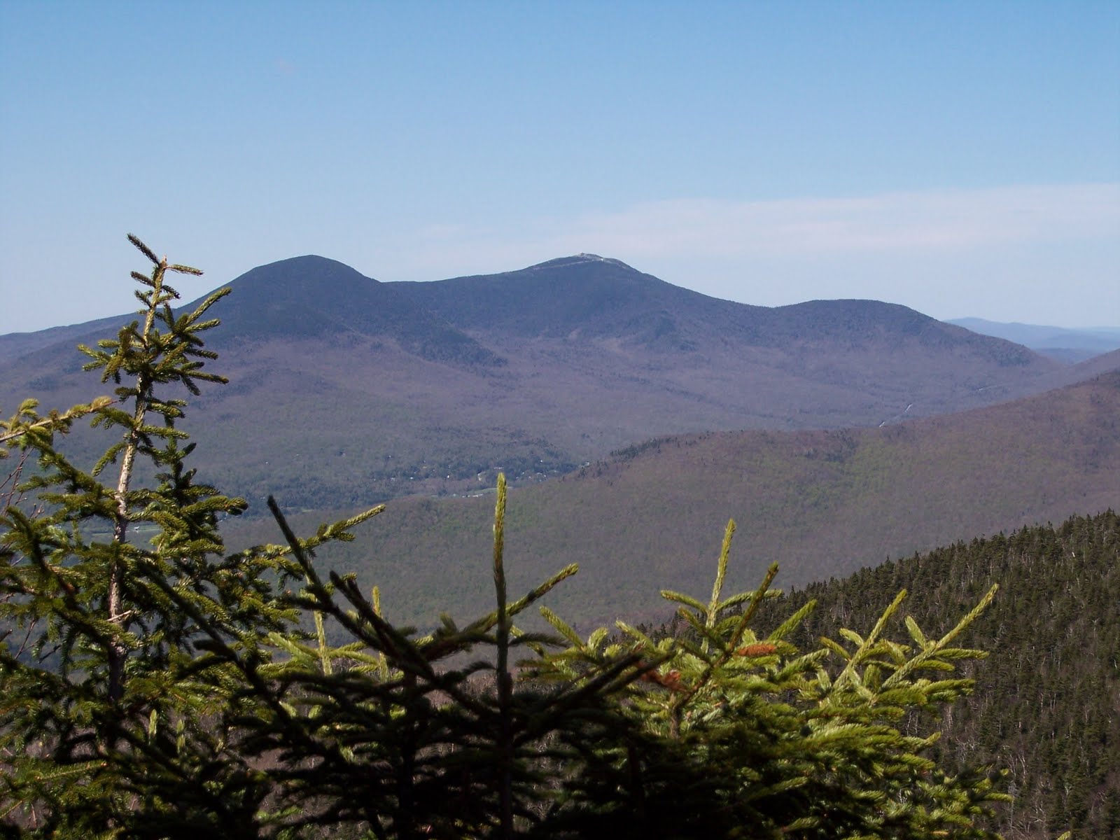
As I ascend Jay Peak it starts to drizzle but not so badly that I have to break out the rain gear. It is 1.7 miles to the peak and all of my running these past few months has really paid off as I make it with ease. At the top (3,858 ft.) I must manuver around some water pies and a fence, cross a ski trail, and continue to climb. At the very peak there is a ski-lift station and I take some stairs off the rocks and get on a ski trail for several hundered yards. The view from up here is non-existent given all of the cloud cover and the wind is whipping hard.

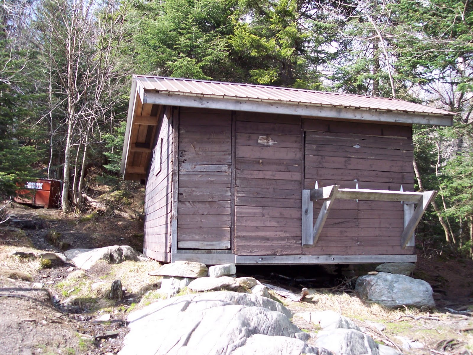
I am pleased to be heading off of the peak given the cold wind. It is 1.5 miles down to the Laura Windward Shelter (built 1956, sleeps six, 2,800 ft). The trip down is relatively easy, although there is still a fair amount of snow (3 feet in places) and I have to navigate the first ice of this year's hikes. The trail is very well marked, however, in this region.

I now undertake a 0.9 mile ascent of Doll Peak (3,409 ft). The climb is steady but smooth. I then proceed down and up 0.5 miles to an unnamed "peak" on North Jay Mountain. On the descent from North Jay I encounter a bit more snow but no ice. The northern side of the mountains are wet, slippery, and more likely to have snow until June I have found.

I now take a very pleasant 2.9 mile hike down North Jay to Shooting Star Shelter. The trail is soft, forgiving, and feels very good on my feet. I make excellent time down and arrive at the shelter feeling very positive as the misty rain has ceased for good it seems. The shelter (built 2001, sleeps six, 2,260 ft) is situated on a prominant rock outcropping that I find rather slippery to negotiate. I rest here for all of about three minutes before pushing on.

I climb steadily for 0.6 miles to the peak of Burnt Mountain and then descend 1.2 miles, again gently and speedily, to my parked car at VT 105 and the North Jay Pass. I have traveled 9.3 miles in five hours. Feeling good, I drive back to my starting point and hike the Jay Loop mentioned earlier, bringing my total mileage today to 10.2 miles.

Monday, May 17, 2010

Stage 20 - LT Day Hike from Belvidere to Hazen's Notch


On Sunday, May 16, 2010, a beautiful sunny day with temperatures in the 60's, I was able to check off another stage on the Long Trail. I begin on Vt 118 in Eden Crossing and head north from the LT trailhead (1,320 ft above sea level). I cross several brooks, one named Frying Pan Brook (picture above center) and begin to climb steadily up Belvidere Mountain. At 2.6 miles I intersect with Forrester's Trail.

I turn right onto Forrester's trail and continue 0.2 miles to the summit of Belvidere (3,200 ft). A fire tower is maintained on the summit and I climb halfway up to take photos. You can see in all directions but the wind is probably blowing 30 miles per hour so I choose not the climb to the top. The picture above right shows an old Asbestos mining operation on the northeast side of the mountain. The picture below left shows Jay Peak and Big Jay that I will climb on my next LT hike.

From the summit I back track to the LT and then take Forrester's trail down the mountain a ways to make up for my failed attempt to hike the trail to the summit two weeks ago when the snow was too deep. In a short couple of hundred yards I arrive at the spot where I abandoned the attempt before. I'm surprised how close I was to the LT. Now I can officially say I've hiked the entire Forrester's trail.

Once again it is back to the LT and a turn north to hike 2.8 miles to Tillotson Camp. I descend Belvidere and, in the valley below, I come to a picturesque Beaver Pond and pause to enjoy the view. I then begin the climb up Tillotson to the Camp (2,560 ft). I've been to the camp before from the Frank Post Trailhead.

I now have a 0.6 mile climb to Tillotson Peak (2,980 ft). From Tillotson Peak I have a 2.1 mile down and up hike to the east summitt of Haystack Mountain (3,180 ft). This mountain is deceiving. I hike to what I think is the peak and, as I crest the rise, discover a higher peak ahead. I do this four times before I reach the summit. It does not feel like a mere 2.1 miles when I get there. At the top there is a 0.2 side trail called Haystack Summit Trail that I climb even though it is not an official side trail of the LT (it should be).

From the view atop Haystack I descend steeply 1.9 miles to Hazen's Notch where my car is parked (2,040 ft). Being the north slope, it is wet and slippery from the recent snow melt and I pick my way carefully. Several times I sit and slide down a rock slide as I'm sure my boots won't hold on the wet angled rocks.

As I approach the Notch I pass a young family hiking up. Once again a foolish father has his infant child in a chest sling and is hiking up wet rocks. I almost say something about how risky it will be coming down, but don't. His wife and 2-3 year old daughter are behind him and the youngster tells her mom that I'm a "nature man" as I pass them. 50 yards later, and still thinking about the danger of hiking wet rocks with a baby strapped to you, I hit a slick spot and my feet fly out from under me. I land on my side and slide a few feet. I'm fine but my right side is soaked. I say a little prayer that the father doesn't meet the same fate.

I arrive at the Notch at just after 4:00 pm so I have hiked 11.2 miles in just over 6 hours. I take a photo of the cliffside were Peregrine Falcons nest and drive home to a great dinner my wife has fixed.

Thursday, May 6, 2010

Stage 19 - LT Hike from VT. 58 to VT. 242


On Tuesday, May 4, 2010 I am able to get away for a day hike on the Trail. i decide to skip the Belvidere Mountain section and give it another week for snow to melt. Over the weekend, 10 inches of snow fell in northern VT so I suspect there is still plenty of snow up on Belvidere. The section I'm doing today is north of Belvidere but is not at such a high elevation and I believe i should be free of most snow.

My wife, Kim, drops me off at the trailhead at 10:30 am on an overcast day that calls for scattered thunderstorms. I cross my fingers and take off. I enter the LT going north into Hazen's Notch (1,780 ft above sea level). The Notch is named for General Moses Hazen who built a military road from Peachem, VT to this point. The road was intended to reach Canada but was not completed. After just seven minutes on the hike I reach out to grab a small tree I must work around and I grab a spot with a broken branch that takes the skin off of the piece of meat between my thumb and forefinger of my right hand. It bleeds like a stuck pig for the next 10 minutes and makes it tough to grip my hiking staff for the rest of the hike. Over the next 1.4 miles I travel level ground and then ascend steadily over Sugarloaf Mountain. I then descend a short distance to a 0.1 spur leading west to Hazen's Notch Camp.

From Hazen's Notch Camp (sleeps 8, built 1948, 2,040 ft) I return to the LT and head north. I ascend steadily to a skyline view at Bruce Peak (2,900 ft.). From there I begin a down, then up, cycle taking me to the summit of Buchanan Mountain (2,940), Chet's Lookout (2,900 ft., see picture at right) and Domeys Dome (2,880 ft). Finally, I ascend Gilpin Mountain (2,940 ft) and begin the 0.8 mile descent to VT 242 (2,220 Ft.).

Along the way the sky threatens to dump a storm on me constantly, but the most I ever get is a 10 minute light sprinkle. I arrive at the car at about 2:30 pm having covered about 7.2 miles in four hours. I feel good at how strong I felt during the hike and about my prospects of finishing the LT before I leave for Florida.

Forrester's Trail and Frank Post Trail Day Hike


On Saturday, May 1, i took my first hike of the season. About one month ago I was named the new President of Northwest Florida State College. I begin my duties on June 21 so I have a short window during which to complete the hikes that constitute the Vermont Long Trail and the Official Side Trails. By my calculation i have 5-6 hikes to take over the next 6 weeks, weather permitting.

This day I am climbing Belvidere Mountain via Forrester's Trail. I arrive at the trailhead of the Frank Post Trail (1,380 ft above sea level) near Eden, VT. at about noon. It is cool and I wear long pants and a long sleeve hiking shirt. I hike a short 0.6 miles up a gradual ascent on a snowmobile trail to the Intersection with the Forester's Trail (1,480 ft).

I turn Southwest onto Forrester's trail and ascend gradually, crossing Lockwood Brook and several other small streams for about 1.5 miles until I reach snow. It is the start of May and I had hoped the mountain would be free of snow fall. I work my way through increasingly, deep snow banks with the worst ones coming in at about mid-thigh. I carefully try to follow the blue blazes as the trail is obscured by the snow. It takes 20-30 minutes to climb another 2-3 tenths of a mile when I lose the blue markers and decide I must retreat.

I figure I am within a few hundred yards of the LT but do not wish to get lost on a mountain in the snow. I descend through the snow much faster than I went up and, in short order, return to the Frank Post Trail intersection. The Forrester's Trail climbs the north face of Belvidere Mountain (3,360 ft) and I'm hopeful that it is just the north face that is snow-covered so I now turn Northwest and try my hand at the Frank Post Trail.

This trail is an easier climb and has much less snow and no ice. After 1.4 miles of climbing steadily, I suddenly round a corner and am at Tillotson Camp (sleeps 8, built 1936, 2,560 ft). The view is to the south from the cabin and I pause briefly to soak it in and then begin my descent.

I make good time hiking the 2.1 miles back down to my car and recross several picturesque streams and water slides on the way down. I arrive back at my car at about 4:00 pm having hiked just over 7 miles in about four hours.